搜索结果: 1-10 共查到“地球科学总论 the map”相关记录10条 . 查询时间(0.156 秒)
Towards a publicly available, map-based regional software tool to estimate unregulated daily streamflow at ungauged rivers
publicly available map-based regional software tool estimate unregulated daily streamflow ungauged rivers
2014/12/17
Streamflow information is critical for addressing any number of hydrologic problems. Often, streamflow information is needed at locations that are ungauged and, therefore, have no observations on whic...
Near surface geophysics techniques and geomorphological approach to reconstruct the hazard cave map in historical and urban areas
Near surface geophysics techniques geomorphological approach the hazard cave map in historical and urban areas
2010/9/13
This work, carried out with an integrated methodological approach, focuses on the use of near surface geophysics techniques, such as ground penetrating radar and electrical resistivity tomography (ERT...
Landslides density map of S. Miguel Island, Azores archipelago
Landslides density map S. Miguel Island, Azores archipelago
2009/12/9
The Azores archipelago is located in the Atlantic Ocean and is composed of nine volcanic islands. S. Miguel, the largest one, is formed by three active, E-W trending, trachytic central volcanoes with ...

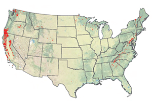
Geologists Map Rocks to Soak CO2 From Air--6,000 Square Miles in U.S. Might Turn Emissions to Harmless Solids(图)
Geologists Map 6,000 Square Miles in U.S. Emissions Harmless Solids
2009/12/10
To slow global warming, scientists are exploring ways to pull carbon dioxide from the air and safely lock it away. Trees already do this naturally through photosynthesis; now, in a new report, geologi...

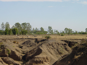
Scientists to Map Out Earth's Soil--New tool will help explain and solve world’s greatest environmental threats(图)
Earth's Soil world’s greatest environmental threats
2009/12/10
New York, February 17, 2009 — Some of the answers to the world’s greatest challenges -- such as climate change, food security, and water scarcity -- lie right beneath our feet. Responding to these and...
Using stochastic space-time models to map extreme precipitation in southern Portugal
stochastic space-time models extreme precipitation southern Portugal
2009/12/30
The topographic characteristics and spatial climatic diversity are significant in the South of continental Portugal where the rainfall regime is typically Mediterranean. Direct sequential cosimulation...
Liquefaction severity map for Aksaray city center (Central Anatolia, Turkey)
Liquefaction severity map Aksaray city center
2009/12/30
In this study, the liquefaction potential of the Aksaray province is investigated by recent procedure suggested by Sonmez and Gokceoglu (2005). For this purpose, the liquefaction susceptibility map of...
Probabilistic seismic hazard map for Bulgaria as a basis for a new building code
Probabilistic seismic hazard map Bulgaria new building code
2009/12/30
A seismic hazard map proposed as part of a new building code for Bulgaria is presented here on basis of the recommendations in EUROCODE 8.Seismic source zones within an area of about 200 km around Bul...
Probabilistic seismic hazard map for Romania as a basis for a new building code
Probabilistic seismic hazard map Romania new building code
2009/12/29
A seismic hazard map proposed as part of a new building code for Romania is presented here on basis of the recommendations in EUROCODE 8.Seismic source zones within an area of about 200 km around Roma...
3DVAR assimilation of SSM/I data over the sea for the IOP2b MAP case
3DVAR assimilation SSM/I data the sea the IOP2b MAP case
2010/1/22
Data assimilation by 3DVAR of data from the Special Sensor Microwave/Imager (SSM/I) has been performed to study the IOP2b case (19-21 September 1999) of the Mesoscale Alpine Programme (MAP). Only data...

