
搜索结果: 1-15 共查到“知识库 Technology”相关记录933条 . 查询时间(0.187 秒)
Transparent and mechanically robust Polyvinyl-alcohol nanocomposites based on multiple cross-linked networks for paper-reinforcement Technology
PVA nanocomposites Multiple cross-linking network Boron-hydroxyl coordination Blocked diisocyanate Nano-SiO2
2023/12/1
Materials based on fiber-reinforced coating have gained increasing attention due to their environmental and industrial application tracks. Polyvinyl alcohol (PVA) composites with interpenetrating cros...

浙江大学环境与资源学院王飞儿课题组在Environmental Science & Technology上发文构建了基于机器学习的土壤吸附重金属预测模型(图)
王飞儿 机器学习 土壤吸附重金属预测
2022/10/26
土壤对重金属吸附性能是决定重金属在土壤中迁移转化及环境风险的重要因素。然而,通过实验方法和传统吸附模型获得吸附性能不但费时,而且适用范围比较局限。2021年10月14日,浙江大学环境与资源学院王飞儿副教授研究团队联合美国凯斯西储大学张慧春教授研究团队在环境领域国际知名期刊Environmental Science & Technology上发表了题为“Predicting Heavy Metal ...
2021年9月24日,浙江大学梁新强教授研究团队在环境领域国际知名期刊Environmental Science & Technology上发表了题为 “The trace-level sensing of phosphate for natural soils by a nano screen printed electrode” 的研究论文(DOI:https://doi.org/10.102...

浙江大学环境与资源学院梁新强课题组在《Environmental Science & Technology》上发文揭示土壤有机碳协同控制胶体磷形成的内在机制(图)
梁新强 土壤有机碳 胶体磷形成
2022/10/26
农田土壤胶体磷流失是造成我国河流、湖库等水体富营养化的主要原因之一,但目前对土壤胶体磷的形成、分布和迁移特征存在知识缺口,在微观机制上更缺乏深入认识。2021年4月20日,浙江大学面源污染研究团队联合德国于利希研究中心等单位在环境领域国际知名期刊Environmental Science & Technology(IF5=8.54)上发表了题为 “Organic carbon linkage wi...
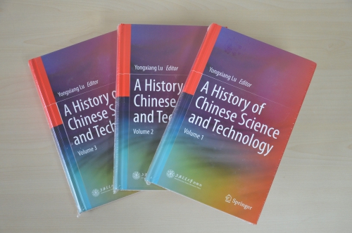
中国科学院路甬祥院士主编、中国科学院自然科学史研究所及国内相关单位专家合著的《中国科学技术史(英文版)》(A History of Chinese Science and Technology)一书,2015年7月由上海交通大学出版社和斯普林格出版社(Springer)联合出版。《中国科学技术史(英文版)》共三册,是在先期出版的《走进殿堂的中国古代科技史》中文本基础上重校、翻译而成。该书包括综论、...
IMPORTANCE OF INCORPORATION OF GEOSPATIAL TECHNOLOGY APPLICATIONS IN WATER RESOURCES AT GRADUATE AND POST-GRADUATE COURSES OF CIVIL ENGINEERING
water resources geospatial technology civil engineering course curriculum
2019/2/27
Water is a very crucial element to sustain life on earth. The availability of water varies both spatially and temporally. India being a water stress country, the per capita availability of water is re...
TRAINING, EDUCATION, RESEARCH AND CAPACITY BUILDING NEEDS AND FUTURE REQUIREMENTS IN APPLICATIONS OF GEOSPATIAL TECHNOLOGY FOR WATER RESOURCES MANAGEMENT
Geospatial technology Water resources Education and Training
2019/2/27
In India, water resources are managed at different levels, i.e. at central level by Ministry of Water Resources, River Development & Ganga Rejuvenation, Central Water Commission and Central Ground Wat...
AN EVALUATION OF MULTI TIER APPROACH TOWARDS CAPACITY BUILDING AND INSTITUTIONAL STRENGTHENING THROUGH APPLICATION OF GEO SPATIAL TECHNOLOGY IN PURVIEW OF AMRUT SCHEME
Capacity Building Multi Tier Approach Urban Planning Geo-spatial technology AMRUT
2019/2/27
Many initiatives around the world are emphasising to strengthen the capacities of civil society and local governments to build resilience towards the context of urban planning. The Indian cities are e...
RESEARCH ON METHODS OF HIGH COHERENT TARGET EXTRACTION IN URBAN AREA BASED ON PSINSAR TECHNOLOGY
PS points extraction Dispersion of intensity Amplitude threshold Phase analysis Ground deformation
2018/5/14
PSInSAR technology has been widely applied in ground deformation monitoring. Accurate identification of Persistent Scatterers (PS) is key to the success of PSInSAR data processing. In this paper, the ...
ASSESSMENT OF GRASSLAND HEALTH BASED ON SPATIAL INFORMATION TECHNOLOGY IN CHANGJI AUTONOMOUS PREFECTURE, XINJIANG
Health assessment PSR model RS technology GIS technology Entropy method
2018/5/11
Based on the “pressure-state-response” (PSR) model, comprehensively applied GIS and RS techniques, 20 evaluation indicators were selected based on pressure, state and response, the entropy weight meth...
APPLICATION OF INSAR TECHNOLOGY IN GEOGRAPHICAL SITUATION MONITORING
InSAR Geographical situation monitoring D-InSAR The terrain Deformation Interference figure Application
2018/5/15
In this paper, based on the geographical situation monitoring project of the earthquake zone of ludian county, zhaotong city, yunnan province,using the data of the radarsat-2 satellite (time frame is ...
RESEARCH ON COORDINATE TRANSFORMATION METHOD OF GB-SAR IMAGE SUPPORTED BY 3D LASER SCANNING TECHNOLOGY
GB-SAR Interference measurement 3D laser scanning Coordinate Transformation
2018/5/15
In the image plane of GB-SAR, identification of deformation distribution is usually carried out by artificial interpretation. This method requires analysts to have adequate experience of radar imaging...
VEGETATION MONITORING BY REMOTE SENSING TECHNOLOGY FOR UNINHABITED ISLANDS OF THE XISHA ISLANDS
the Xisha Islands Remote Sensing Uninhabited Island Vegetation Remote Vegetation Monitoring Island Development
2018/5/14
The Xisha islands are tropical coral islands in the south sea of China, with special ecological environment. As far away from the inland, they are more sensitive to climate change than inland, and are...
ANALYSIS OF LAND SUBSIDENCE MONITORING IN MINING AREA WITH TIME-SERIES INSAR TECHNOLOGY
Time-series InSAR Land Subsidence ALOS PALSAR RADARSAT-2
2018/5/15
Time-series InSAR technology has become a popular land subsidence monitoring method in recent years, because of its advantages such as high accuracy, wide area, low expenditure, intensive monitoring p...
METHODS FROM INFORMATION EXTRACTION FROM LIDAR INTENSITY DATA AND MULTISPECTRAL LIDAR TECHNOLOGY
Classification Information Extraction LiDAR Intensity Multispectral LiDAR
2018/5/15
LiDAR is a consolidated technology for topographic mapping and 3D reconstruction, which is implemented in several platforms On the other hand, the exploitation of the geometric information has been co...